5:09



The weather forecast on WUSA 9 is sponsored by Morgan& Morgan. We can enjoy another dry day today before the rain comes tomorrow. I'm Mary Marsh, and this is the weather forecast for WUSA 9 Weather warning for Sunday: Rain will fall most of the day, with the heaviest precipitation expected from 6:00 a.m. to 1:00 p.m. The latest models show the system moving a little faster, but that increases the risk of severe storms. This means that we can expect the impact of the elements to ease a little earlier. However, while she is here, the phenomena may be a bit more intense. We may experience localized flooding due to heavy rains brought by the remnants of Isaiah.
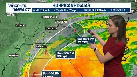
Wind gusts are possible, which could cause damage. This risk is low, but there is also a risk of a single tornado. I will outline the areas where I think this is most likely. This will not necessarily affect the entire territory, but it is possible in several places. This is what's left of Isaiah, it's no longer a hurricane or a tropical storm. This is an area of low pressure moving north and east into our region, so the chance of rain will increase tonight and into Sunday. Here is a timeline of what will happen. Of course, we know that rains and storms are coming. Most of Saturday will be dry, but showers are quite possible after 6:00 PM on Saturday. For the Washington metropolitan area itself, rain is not likely until 8:00
p.m.-11:00 p.m. This is the approximate time frame for the onset of precipitation in the metropolitan area. Then the rain will continue for most of the day on Sunday, with the heaviest rain from about 6:00 a.m. to 1:00 p.m. As I said, severe weather is possible. The next few hours will look like this. You can see rain approaching, but it won't start until later at night. So, you have the whole day of Saturday to enjoy the absence of rain. 68 degrees at 1pm, around 69 degrees by 5pm today. Weekend forecast: Temperatures are just above 70 degrees today, with rain expected overnight. 70 degrees Sunday, weather warning in effect, rain all day Sunday. Now let's look at a more detailed hourly scale using Futurecast. It is 5:00 PM today. It's still
relatively dry outside. Light showers are possible along the orange zone around 6:30 p.m.: Fredericksburg, Culpeper. You will be the first to feel this rain. Then by 8 p.m., a few light drops will try to reach Loudoun and Fairfax, possibly southern Prince George's County, or the southern border of the District of Columbia. And by 11:00 PM, it will start raining everywhere. This will last all Saturday night. We will wake up to a very humid Sunday morning. It's 6:00 in the morning. We are at the peak when you see multiple pockets of heavy rain moving through the region. This is your Sunday, 8:00 AM. We are still being hit by these pockets of intense rainfall.
Remember that tropical humidity is involved. When you hear the word "tropical," expect heavy rain and lots of humidity. The glass is full when it comes to humidity. This is your Sunday, 12:00 noon. We still have to deal with occasional heavy rains. It's 1:30. At this point, yes, there are still pockets of heavy rain, but notice the difference. Some of these showers have dissipated and become weaker in a few areas. So relief will start a little earlier in some places as the heaviest rain begins to move away after lunch on Sunday. It's 3:00 p.m. We know that the game " Commanders" is in progress. So, at the beginning of the game, yes, you will have rain. Perhaps towards the end the showers may subside a bit or even stop for a short time. This should
help when playing outdoors. It's 3:00 PM, and it's already 4:30 PM. We see temperatures rising into the 70s on Sunday, but by 4:30 p.m. much of the steady rain will start to move away. Again, this is a scenario that is evolving faster. According to the latest data, the system will leave us a little earlier. This does not mean that there will be no more rain on Sunday evening. There will still be occasional showers, but the heavy rain will have stopped. We can get some rest from this downpour. The risk of severe weather conditions will also decrease. So, the threat of tornadoes, where can we observe it? Right now we're seeing it mostly south of DC, in areas like
Leonardtown and the lower East Coast. These are areas that we are monitoring very closely due to the possibility of tornadoes occurring there. The Storm Prediction Center has declared a slight risk of severe storms for this area. For the rest of the DMV region, I think it will be mostly normal rain. An isolated clap of thunder and gusty winds are possible, but the threat of severe weather will be somewhat higher south of the District of Columbia. So, yes, we can still feel it in our area, but further south, around Leonardtown, the likelihood of it is higher. You have to be careful there. To sum up Sunday: heavy rains are expected, which could lead to flooding in some neighborhoods, and strong gusts of wind are also possible.
I repeat, the risk of severe weather exists, it is low, but it is there. The Army 10-mile race-oh my god, it's going to be so wet. 62 to 65 degrees, cloudy with rain, even during the Commanders game, especially early in the match. You may encounter showers closer to halftime and the end of the game, the showers may become a little lighter, maybe even stop for a moment, but at the start of the game and during the parking lot party-oh yeah, it's going to be wet. Your 7-day forecast: 73 today, 70 tomorrow with showers and thunderstorms, Monday around 75. A few drops in the morning, then we'll be dry Monday afternoon. Near 80 Tuesday, 71 Wednesday, 70 Thursday, returning to just below 70 with light rain on Friday.
Now, if you want to track the rain like we do, use this QR code to access our radar, which is available 24/7. On the 10-day temperature chart, we see a jump to 80 degrees, then a return to 50-60 degrees late next week.