25:01



You like the warmth? Well, you're in luck. 80s are here for a while. And Alex, we won't be seeing rain until possibly next weekend, right? We are. There's still a lot of uncertainty there, but we're just alerting you now, letting you know, hey, we're feeling some changes by next weekend. Boy, it was beautiful in Britney's live shot. Love to see that. It's really nice evening. We're under a mostly clear sky. Temperatures in the 60s. Some of us still feeling 70s out there. So, the warm, dry conditions stick around for now. We'll still have some periods of offshore Santa Ana winds with us. A coastal flood advisory. That's the big story for our local beaches. And then we're looking at those changes as we move into next weekend. So
outside this evening across Los Angeles, Orange County, temperatures down into the high 60s. That is where we will stay over the next about two hours. Then temperatures sinking down to the low 60s. It is going to be chilly for some as we head into the overnight hours, especially if you're in the Analopee Valley and Lancaster and Palmdale. uh temperatures and even in Victorville we'll be down into the 40s. So that is what we will feel to start off Sunday morning. Temperatures closer to the water in the high 50s to low 60s. By the afternoon, another warm day as temperatures will hover in the mid to high 80s across Los Angeles. Just to put it into perspective, average is about
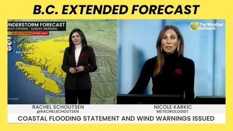
75. So many areas about 10 to even 15 degrees above average. San Fernando Valley temperatures hovering near 90 degrees over the next few days. So, not just Sunday, but that's going to continue as we head into Monday and into Tuesday as well. So, the takeaway is if you like the warmer temperatures, you're going to like what we have in store for you over the next few days. Now, at the coastline, here's what you need to know. We do have a coastal flood advisory that is specifically for Orange County beaches. So, what you see in this green color here, uh that is going to be with us over the next few mornings. So, we could see some minor to moderate
flooding, especially near high tide in the morning. Waves will be around four to six feet. A high risk of dangerous rip currents. And then we also have the beach hazard statement in effect for LA beaches and Ventura County beaches. So, again, just know we'll continue to have that elevated surf and the rip current risk as we head through the next few days. As far as what's happening here, it will be the warm temperatures sticking around as we've got high pressure that is holding steady. In fact, strengthening as we head into the middle of the week. So, warm and dry once we move into next weekend. We're starting to track some changes as we see low pressure approaching. So, temperatures will drop beginning Thursday, but really more so Friday and
into the weekend. Now, I have issued a next weather watch to let you know, alert you of the changes in store. There's still again a lot of uncertainty as far as the rain timing, how much rain we could see, all of that still very uncertain. But what we do know is the warmth is sticking around for now, the dry conditions, and we're looking at a slight chance of showers heading into next weekend. Gio and Lesie, we'll send it back to you, Alex. Thank you so much.