20:42



Congratulations, we're so glad you've joined us at Weather Network. Today, Tuesday, October 20, is the "In the Know" program, with meteorologist Nadine Powell and Chris Murphy. Nadine, much of the country is enjoying sunny weather and seasonal temperatures, but not everywhere. We would like to start with a video about what kind of weather October can still bring to some regions of the country. Yes, we start with Salyut, Quebec. You see a lot of snow on the ground, it's falling, and it's not just Quebec, it's Newfoundland. We are on a walk in Corner Brook, where you can see light snowflakes against a background of autumn leaves.
Yes, it was a sea effect over the weekend, but do you know what's happening in the Carolinas? They are preparing for the weather and strengthening the dunes because a northeast storm is raging there, which will bring days of rain and strong surf, and this is a problem not only for the United States. It is possible that this will become a problem for Canada as well. Yes, look at the Carolina coast, there are two possible scenarios in the coming days, Chris. The first is a ridge of high pressure that extends out to sea. You see the low pressure area moving slowly and staying far from our coast. So, perhaps the impact on precipitation for us will be less, as most of it will remain in the sea. This is the first scenario.
This is the first scenario. However, the second scenario predicts that this low pressure area will linger. It will still be there, but it will wait for the high pressure area to move away and then take advantage of the opportunity. It's almost like the phrase: "When the cat is away, the mice dance." That's right. So the storm will move a little further north, and if that scenario plays out, Nadine, we can expect heavy rains in eastern Nova Scotia, Prince Edward Island, and parts of We are closely monitoring this, as a northeast storm is synonymous with strong winds. The East Coast of the US, devastating waves, strong winds, and again the question arises regarding scenarios: how severe will the wind impact be for us in Atlantic Canada?
That's right. The further out to sea a cyclone is, the less wind influence it has; if it approaches the coast, then we can expect strong winds. And also, not only rain, but on Thursday night we can expect periods of snowfall. And, uh, it's likely to be inland and on higher ground. Speaking of snow, let's head to the Yukon Territory, where we have numerous warnings. We have gale force wind warnings in effect from today until Wednesday morning. Blizzard on Dempster Highway, along with snowfall warnings, potentially up to 25 cm by Wednesday. Yes, the extreme northern regions of the Northwest Territories, i.e. Nuvik, Fort McPherson, the South Delta region. But these winds can be strong enough to cause power outages. So, in Whitehorse and Teslin, uh, Carmack
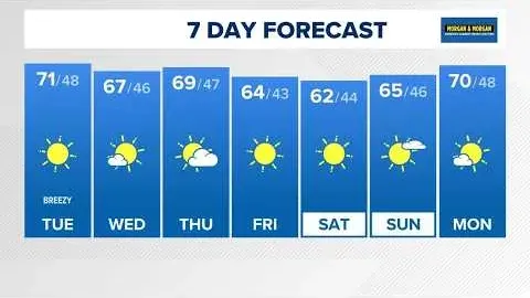
, for example, and even watch out for snow drifts around White Pass tonight. This is the same higher elevation near the border with British Columbia. Okay, what are we looking at here, Nadine? So Calgary, Regina, Winnipeg, the trend is: you're pretty warm, around 20°, but by the weekend, look at those temperatures dropping dramatically, Chris. Yes, here's another way to look at it. Thursday, 17°, sunny, life is beautiful there. And then on Friday it's windy again and we have a mix of rain and snow and a drop in temperature. Toronto, meanwhile, is consistently sunny and seasonally clear through the rest of the week, and likely into the weekend. And Nadine, Vancouver and Victoria, this October has been very dry.
Yes, we should have more precipitation this season, but unfortunately, none is expected yet.